Description

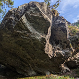
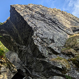
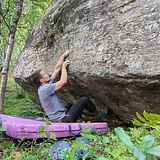
Located in the stunning Transfarelvdalen valley, this bouldering area offers a variety of routes set on a forested plateau. Known for its rugged terrain and peaceful surroundings, Transfarelvdalen provides a perfect mix of challenges and relaxation for climbers of all levels. The boulders are scattered across a relatively small area, with a range of difficulties, from beginner-friendly problems to more advanced routes waiting for their first ascent

🪨 The rock dries relatively fast as there isnt alot of moss on the boulders, and the best season of climbing is generally May through September. Winter bouldering is also possible during the coldest months if you want the crisp cold feeling.

The boulders at Transfarelvdalen vary in style, featuring sharp crimps, slopers, and some nasty overhangs. The range of problems makes it an ideal spot for climbers of all abilities. Whether you’re looking for easy slabs or more technical overhangs, you'll find something to challenge yourself 🪥

🟢Area is still being delevoped. Suggesting lines is highly encouraged!
History

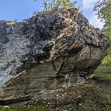
Little known climbing activity before 2021 when Ramberg og Boine started climbing the area. The boulders are easily spotted from the hiking trail. Additional lines brushed by Paulsen in 2024.

Routes on Transfarelvdalen
9 boulder 3 Likes
Photos
Premium topo by Kaiskuru
Bjørnulf Håkenrud
from Alta, Norway
Torgrim Dahl
from Alta
Martin Andreas
from Alta
Transfarelvdalen

The area is access sensitive!

🚙 Access by car:
From the city centre, take the E6 going north. After a 15 minute drive, just after the 70 kp/h speed limit zone at Transfarelvmoen, turn right to Himmeldalen.

The gravel road leading to the parking spot is private, but climbers are allowed access. Follow the gravel road about 1,5km until you get a large field on your right side, and park at the sign "klatrefelt" on your left hand side. Parking spot also marked on the map.

👣 On foot:
The approach is very easy, and mostly flat. From the parking spot follow the gravel road for another 600m until you hit the old parking spot now inaccessible by car. From here simply follow the trail until you hit the bouldering area. Once you have hit the first boulder, you can follow the well marked red hiking trail between all the boulders.

🔴WARNING:
A general warning is placed by the county for the risk of landslides on the hiking trail closest to the river.