Access is sensitive
🚗 If you want to get to Paklenica you can do it either from the coastal or the continental side: The coastal option leads from Rijeka by Adriatic Highway, passes Senj, Karlobag all the way to Starigrad... Read more
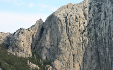
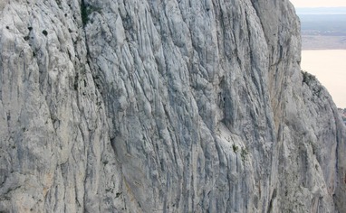
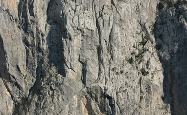
We like Paklenica-Anića kuk


Activities on this crag
Nearby crags


Access is sensitive!
🚗
If you want to get to Paklenica you can do it either from the coastal or the continental side:
The coastal option leads from Rijeka by Adriatic Highway, passes Senj, Karlobag all the way to Starigrad- Paklenica (180 km from Rijeka). Zadar is 46 km to the south of Starigrad.
The continental option is very easy. It leads from Zagreb by highway to Maslenica (junction of the Adriatic road) and further on to Starigrad-Paklenica (270 km from Zagreb). Approximately 200 m from the hotel Alan there is a narrow asphalt road turning off the main road towards the village Marasovići (there is the sign “National Park Paklenica” at the very spot where the roads branch off). Just after passing Marasovići you will see the entrance to the National Park. From here you can drive 2 more km to the parking lot and this parking lot is taken as a starting point for most of the described climbing routes.
🚶🏼♂️
Approach: Along the path passing through Klanci in the direction of Anića luka (meadows at the foot of the rock face) until the penultimate curve where you ought to take the right turn across the creek (signpost). Go upward along not clearly marked path with short hairpin bends. Take a right turn towards Stup and west face. For routes in the north and northwest face you should continue a bit upwards and left along the path at the foot of the rock face all the way to the beginning of the desired route.
🏃🏼♂️Descent: For routes in north and northwest face the normal approach to the top of Anića kuk is also used as descent route. From the routes in the left part of the wall continue straight to the marked path, and along that path left to the foot of the rock face. For routes in the central part of the wall, first get to the top of the Anića kuk and further along the same marked path to the foot of the rock face. For routes in the right part of the wall (from Kača to the right, W face) the right descent route, so called Ðuzin silaz, is more appropriate. It is also marked and partly equipped with steel cables. It leads along SW ridge to the notch between Anića kuk and Ćuk. From here with steel cables to the scree and approximately on the half of it turn right in the direction of Stup.