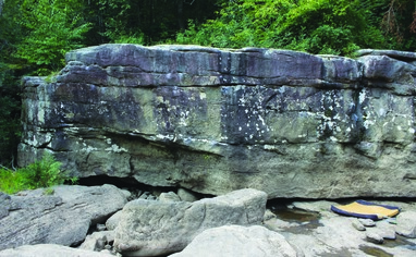
Access is sensitive
***This area is water level dependent. Many boulders are climbable regardless of water level, however lots are water level dependent. See the description of this area on the home page of Summersville D... Read more
We like Summersville Dam Boulders

Activities on this crag
Nearby crags


Access is sensitive!
***This area is water level dependent. Many boulders are climbable regardless of water level, however lots are water level dependent. See the description of this area on the home page of Summersville Dam Boulders for specific water level information before you climb here.
You can use this site to find the current river level:
https://waterdata.usgs.gov/monitoring-location/03189600/
Driving Directions:
From Fayetteville, turn right onto US-19N and drive north for 17 miles, crossing over two beautiful bridges. When you get to the first stoplight, make a left onto WV-129. In 3 miles, drive over the Summersville Dam, then make your second left at the sign that says "Gauley River Access" (the first left is the ranger station parking lot). Follow the road as it switches back down the hill and into the parking lot at the bottom. Parallel park near the gated-off river-access road straight ahead for the upstream end of the boulders (Morning Glory Boulder to the Danger Zone Boulder), or behind the pit toilets in the back of the campground for the downstream end of the boulderfield (The Danger Zone Boulder to the Truncated Boulder).
Hiking Directions:
Upstream: Hike down the gated river-access road that is 200 yards before the campground for the upstream end of the boulderfield. To reach the Morning Glory Boulder, take the left trail just before the small building. Walk along the beach or, at higher water, the fishing trail through the woods. to get downstream to all of the other boulders.
Downstream: Hike the gated road behind the pit toilet in the back of the campground to its end (keeping left at the fork). As of fall 2022 this road is being converted into more camping sites. The trail then turns left, gets much smaller, and goes steeply downhill to the river. To find the Gauley Gee Boulders, keep an eye out to your right for a tiny chainlink-fenced in section of woods. Turn into the woods and walk along the first edge of the fenced in area to get behind it. Follow the small trail up the till behind the fenced in area to the boulders. For the rest of the boulders, follow the main trail (keeping left at the fork) down to the river's edge. The Express Boulder and everything further downstream will be to your right. The rest of the boulders will be to your left. The riverbed has rock hopping, scrambling, and routefinding. If the water is high, the highwater trail has overhanging branches that catch your pad. The Gauley Gee Boulders have a flat walk to a short but steep, poorly maintained trail going up to and around the boulders. Total hiking time: 2-20 minutes.