Description

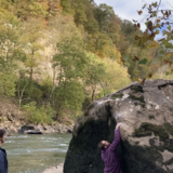
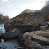
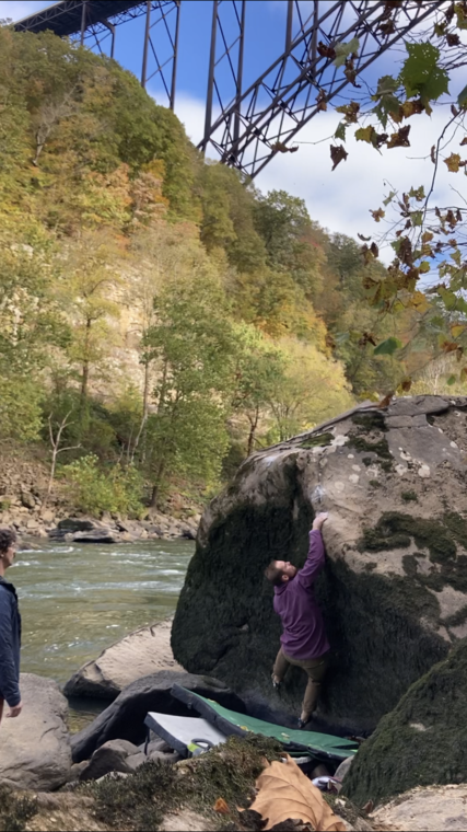
This is a brand new area between Fayette Station and the Sunshine Boulders. It makes the riverside walk to the 1, 2, Punch Boulder (Sunshine) more palatable because now there are boulders to stop at along the way. There are many more problems here open for the taking. Some riverside boulder problems in this area (Copperhead, Patina Sisters, and Trim and a Haircut Boulders) are water level dependent. If the water level is around negative 1ft or below, all are easily accessible. See https://www.americanwhitewater.org/content/Gauge2/detail/id/43472/ for current water levels.

🚶‍♂️ Approach summary - Rugged. 6-15 minutes.
💎 Notable problems -
💧 Dry time - Hours to 1 day. No additional wait time needed once rock is visibly dry.
🍂❄️🍃 Seasonal Beta - Best fall to spring, it is warm on the river in the summer.
🌊 Water Level Beta - This area is partially water level dependent. If the water level is around negative 1ft or below, all are easily accessible. The Copperhead Boulder, Patina Sisters Boulder, and Trim and a Haircut Boulder may go under water above that. See https://www.americanwhitewater.org/content/Gauge2/detail/id/43472/ for current water levels.
🚗 Drive from downtown Fayetteville - 15 minutes
🚗 Drive from Summersville - 40 minutes
🚽 Bathrooms - Pit toilets at the parking area.
📶 Cell phone service - 1/5, fleeting.
🐶 Dogs - Must be leashed at all times. This is National Park land.

History

People have likely bouldered here for decades, but recorded development of this boulderfield started when Will Nagengast and Eric O'Rear got confused by the vague directions to Sunshine Boulders and rock-hopped to the 1,2, Punch Boulder instead of illegally (but much more easily) walking along the train tracks. Instead of lamenting the more-difficult walk, they were awed by all the undocumented boulders. They DID eventually make it to Sunshine, but along the way, they almost singlehandedly developed an entire boulderfield. The walk isn’t necessarily easy, but it’s rewarding. Enjoy!

Fayette Shine Boulders

The area is access sensitive!

🔴This area is partially water level dependent. If the water level is around negative 1ft or below, all are easily accessible. The Copperhead Boulder, Patina Sisters Boulder, and Trim and a Haircut Boulder may go under water above that. See https://www.americanwhitewater.org/content/Gauge2/detail/id/43472/ for current water levels.

🚗 Driving Directions (ESPECIALLY FOR LARGE VEHICLES):
From Fayetteville, turn right onto US-19N and cross the NRG bridge. Take the second right after the bridge onto Lansing-Edmond Road. Drive up the hill, then take your first right onto Fayette Station Road. Stay left at both forks. After the 2nd fork, the road becomes ONE WAY. Drive down the windy road and under the bridge, and past Bridge Buttress. At the next intersection, take a hard left. now you're headed down the gorge. Go all the way to the bottom and cross the wooden bridge. The road makes an immediate 90 degree turn to follow the river downstream. When the road curves away from the river, take a right and cross the small wooden bridge over the creek. Park in this lot. If there's no parking, there's a backup lot just before the tiny bridge over the creek.

🚶‍♂️ Hiking Directions:
From the parking lot, keep following the gravel road downriver (if you're facing the river, it's flowing to your left). When the final bus parking lot ends, keep walking downriver. It's only a few hundred yards before the backside of the Fayette Station Boulders comes into view at river level. Continue past that. The Copperhead Boulder is just another minute down the river. Watch out for poison ivy growing up between the river rocks. The walking here is adventurous - lots of boulder hopping, scrambling, and routefinding, but there is little to no elevation gain. Total hiking time: 6-15 minutes.