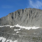
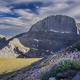
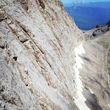
Mount Olympus (/oʊˈlɪmpəs, əˈlɪm-/;[4] Greek: Όλυμπος Olympos, for Modern Greek also transliterated Olimbos, [ˈolimbos] or [ˈolibos]) is the highest mountain in Greece. It is located in the Olympus Range on the border between Thessaly and Macedonia, between the regional units of Pieria and Larissa, about 80 km (50 mi) southwest from Thessaloniki. Mount Olympus has 52 peaks and deep gorges.[5] The highest peak, Mytikas (Μύτικας Mýtikas), meaning "nose", rises to 2,917 metres (9,570 ft).[2] It is one of the highest peaks in Europe in terms of topographic prominence.[6]
Olympus is notable in Greek mythology as the home of the Greek gods, on Mytikas peak. It is also noted for its exceptional biodiversity and rich flora. It has been a National Park, the first in Greece, since 1938. It is also a World Biosphere Reserve.[2]
Every year, thousands of visitors admire its fauna and flora, tour its slopes, and climb its peaks. Organized mountain refuges and various mountaineering and climbing routes are available. The usual starting point for climbing Olympus is the town of Litochoro, on the eastern foothills of the mountain, 100 km (62 mi) from Thessaloniki.
Climbing expeditions
The third highest peak of Mt Olympus, called Agios Antonios (Άγιος Αντώνιος "Saint Anthony", 40.0677°N 22.3511°E, 2,817 m), is known to have been the site of a sanctuary of Zeus in antiquity based on archaeological finds discovered in 1961.[19] In the modern era, a series of explorers tried to study the mountain and to tried to reach its summit. Examples include the French archaeologist Leon Heuzey (1855), the German explorer Heinrich Barth (1862), and the German engineer Edward Richter. Richter tried to reach the summit in 1911 but was abducted by klephts, who also killed the Ottoman gendarmes that accompanied him.
It was just one year after the liberation of northern Greece from Ottoman rule, on 2 August 1913, that the summit of Olympus was finally reached. The Swiss Frédéric Boissonnas and Daniel Baud-Bovy, aided by a hunter of wild goats from Litochoro, Christos Kakkalos, were the first to reach Greece's highest peak.[20][21] Kakkalos, who had much experience climbing Olympus, was the first of the three to climb Mytikas. Afterwards, and till his death in 1976, he was the official guide on Olympus. In 1921, he and Marcel Kurz reached the second highest summit of Olympus, Stefani. Based on these explorations, Kurz in 1923 edited Le Mont Olympe, a book that includes the first detailed map of the summits. In 1928, the painter Vasilis Ithakisios climbed Olympus together with Kakalos, reaching a cave that he named Shelter of the Muses, and he spent many summers painting views of the mountain. Olympus was later photographed and mapped in detail by others, and a series of successful climbs and winter ascents of the steepest summits in difficult weather conditions took place.
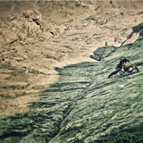
Climbing Mount Olympus is a non-technical hike, except for the final section from the Skala summit to the Mytikas peak, which is a YDS class 3 rock scramble. It is estimated that 10,000 people climb Mount Olympus each year, most of them reaching only the Skolio summit. Most climbs of Mount Olympus start from the town of Litochoro, which took the name City of Gods because of its location at the foot of the mountain. From there a road goes to Prionia, where the hike begins at the bottom of the mountain.
National Park
Greece's highest mountain, dwelling of the Twelve Gods of antiquity, has been the first region in the country to be applied specific protective rules, by its declaration as a National Park in 1938. The aim of this declaration was "...the preservation in perpetuity of the natural environment of the region, i.e. of wild flora, fauna and natural landscape, as well as its cultural and other values...". In addition the declaration has aimed promoting scientific research along with environmental education for the public and tourist development in the region. Specific laws prohibit all forms of exploitation on the eastern side of the mountain in an area of about 4,000 hectares, that is the core of the Park. A wider region, around this core, has been designated "peripheral zone of the National Park", so that its managing and exploitation to be done so as not to adversely affect the core's protection. At present, the park has been expanded to 24,000 hectares. Administratively it belongs to Pieria's and Larissa's Prefectures and specifically to the municipalities Diou-Olympou and Katerinis (Pieria) and Τempon and Elassonas (Larissa). Its lowest altitude is 600 metres and its peak, Mytikas, at 2,917 metres. In 1981 UNESCO proclaimed Olympus "Biosphere Reserve".[29] European Union has listed Olympus in the "Significant for Birdlife Regions of European Union". It is also registered in the list of Natura 2000 European Network as a special protection area and a site of community interest.
In June 2016 the Olympus National Park Information Center, located at Litochoro, opened its gates. It informs their visitors about geology, archaeological sites, mythology, monasteries, plants, animals and other subjects affecting Mount Olympus. Hikers will find help from professional rangers, a guide provides tours for groups in the mountain area.
Olympus' National Park's regulations
The Park is protected by specific legislation. Under the "Special Regulation" entrance to the Park is allowed only by the existing roads and traffic is allowed from sunrise to sunset only on formed paths. The visitor should also know that the following activities are not allowed:[b]
Entrance to children under 14 years unescorted.
Parking in places other than the specific parking lots.
Felling, humus transportation, rooting and collecting shrubs, plants and seeds.
Hunting any animal by any means throughout the year.
Collection and destruction of nests, eggs or chicks and general disturbance and destruction of fauna species.
Damage to geological formations.
Free movement of any animals accompanying visitors.
Refuges
The "Spilios Agapitos" refuge
Spilios Agapitos, the first refuge of the region, is at the site "Βalkoni" (or "Exostis") at 2,100 metres (6,900 ft) altitude. It is in the center of Mavrologos and belongs to Greek Federation of Mountaineering Club (E.O.O.S).
Vrysopoules, the second refuge, is westerly behind Mavratzas' gorge at the site Vrysopoules (1,800 m) and is accessible also by car from Sparmos. It has been managed by the Κ.Ε.Ο.Α.Χ (Army Skiers) since 1961. It provides 30 beds, a kitchen, water, electricity, central heating and a fireplace. It is open all year round, but to overnight a military license is required.
Christos Kakalos is at the southwest edge of Muses' Plateau (2,648 m). It belongs to Greek Federation of Mountaineering and Climbing (Ε.Ο.Ο.Α) that operates it from May to October and provides 18 beds, electricity, blankets, a kitchen and tank water. It is managed by one of the best experienced Greek climbers, the geologist Mihalis Stylas.
Stavros ("Dimitrios Bountolas") is on the eastern side of Olympus, 9.5 km on asphalt road away from Litochoro, at 930 metres (3,050 ft) altitude, in the Dionysios Monastery forest. It belongs to the Greek Mountaineering Club of Thessaloniki, operates all year round, mainly as refreshment room and restaurant and can host 30 persons. It is managed by the Doultsinou family.
Giosos Apostolidis is on Muses' Plateau (Diaselo – 2,760 m) and belongs to the Club of Greek mountaineers of Thessaloniki. It can accommodate 80 persons, it provides electricity, water, a fireplace and an equipped kitchen and it is open from June to October. It is managed by Dimitris Zorbas.
Petrostrouga is on the second, more common, path to Olympus (D10), the same path to reach to Muses' Plateau. This refuge is at 1,900 metres (6,200 ft) altitude, surrounded by perennial Bosnian pines. It can accommodate 60 persons, it provides an equipped kitchen, electricity, water and a fireplace and it is open all year round. It is managed by the Hellenic Rescue Team. It provides organized medical equipment and one of the three emergency heliports in Olympus (the others at Skourta and Spilios Agapitos) and emergency wireless inside and out of the refuge.
Emergency refuges
Emergency refuge of Kostas Migotzidis and at the top behind the refuge of Aghios Antonios
Aghios Antonios emergency refuge on the summit Aghios Antonios (2,817 m) is equipped with emergency items by the Hellenic Rescue Team. In the refuge there is wireless for communication in case of emergency.
Kalyva tou Christaki emergency refuge is in "Megali Gourna" (2,430 m) along the Path E4, Kokinopilos – Skala. The refuge does not provide emergency items (there are only beds) and is only for protection from bad weather.
Kakalos emergency refuge at the "oropedio ton mouson" belongs to the Greek Mountaineering & Climbing Federation and is located at the eastern margin of the Plateau of Muses at an elevation of 2,650 metres (8,690 ft). It was named after Christos Kakalos the Olympus hunter and guide who together with the Swiss climbers Fred Boissonnas and Daniel Baud Bovy made the first recorded ascent to Olympus highest peak Mytikas on 2 August 1913. It has a capacity of 25 people and offers lodging, food and toilets. It is open from mid May to end of October and from December to mid April.
source - wiki.
