
Climbing has been limited
⛔️🦌 At "Landrichterseite" leave the forest one hour before sunset because of animals. ⛔️ 🦅 On this crag climbing at "Annastein" and "Annasteinseite" is prohibited from 1. of Janurary until 31. of July... Read more
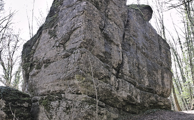
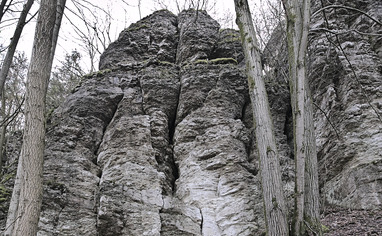
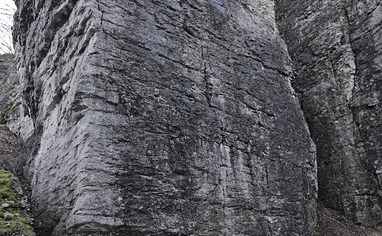
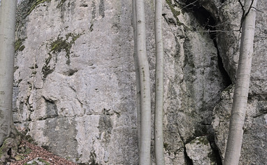
We like Frankendorfer Klettergarten


Activities on this crag
Nearby crags


Climbing has been limited!
⛔️🦌
At "Landrichterseite" leave the forest one hour before sunset because of animals.
⛔️ 🦅
On this crag climbing at "Annastein" and "Annasteinseite" is prohibited from 1. of Janurary until 31. of July because of breeding birds. Rest is open all year until there are no signs at the wall.
🚗
The crag is located north of the picturesque village "Frankendorf" close to "Bamberg". Approaching from West, take motorway to exit #26 and drive east towards "Ebermanstadt". After 2.8 km turn left towards "Gunzendorf", go ahead up north.
For sectores "Annasteine" and Dragonerwand" take parking 1. Leave the village "Frankendorf" behind and drive ahead the street for about 700 meters. Parking is to your left at a small pump house. Another parking is 350 meters ahead.
For sector "Landrichterseite" go to "Frankendorf" and turn of the main road at the church. Drive up the winding road ("Bergweg") for 1.4 km until you reach the top and a field to your left. Park here, leave room for farmers.
🚶♂️
Annastein:
From parking #1 -> Walk up north the road for a few meters. Behind the creek there's a hiking trail to your left leading up the hill. Pass the small forest and go ahead the hiking trail passing the next lawn. Then the trail keeps right into the forest towards the cabin (Almadlerhütte). Sector "Annastein" is just behind the cabin next to the hiking trail.
Annasteinseite:
From parking #1 -> This crag is situated at the hillside behind the "Annastein". The sector is quite stretched from far left to right abreast "Annastein".
Dragonerwand and Kreuzerwand:
From parking #1 -> Take the small path next to the pump house up the slope. Go ahead the forest road you immediately get on for 450meters until you spot a trail branching of left along the hillside. Follow that trail for about 150 meters, then "Dragonerwand" is to your right. Go ahead the path for 150 meters and you reach "Kreuzerwand".
Landrichterseite:
From Parking #2 -> Take the forest road to your left, seen from the approach street. The forest road leads along the edge of the forest and passing a hut. Go ahead the Road for 470 meters until you reach a dip. There are two paths branching off left at a small alley. Take the second path left, going along the edge of the forest again. After 200 meters you enter the forest, go ahead for 100 meters and turn left onto an unclear path leading to a picnic bench. You stay on top of the sector. To get down you have to find a small groove which is situated about 8 meters right of the bench facing the valley. There's a blue painted pole you can orientate. Go down the groove, the main sector is to your left. a few routes are to your right.